Satellite data shows movement of Waterton Fire
-
Share on Facebook
-
Share on Bluesky
-
Share on X
- Copy Link
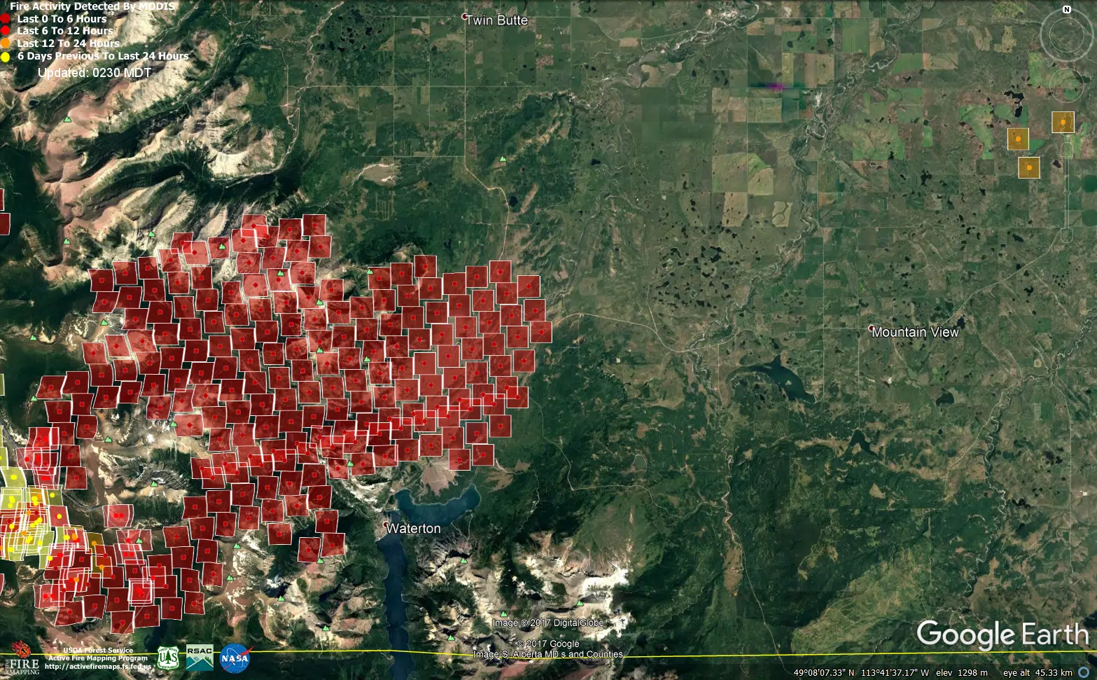
WATERTON LAKES NP – As of 3:00 Tuesday morning, a Modis satellite fire detection map of the Waterton area shows movement of the fire Monday night.
The Kenow fire has advanced on Waterton Monday afternoon, resulting in closures to Highways 5 and 6 at the boundaries of Waterton Lakes National Park.
At that time, the fire was firmly established in the Cameron Valley along the Akamina Parkway, with fire in the Tamarack Basin which grew and moved into the Blakiston Valley and towards the Red Rock Parkway.
Extensive infrastructure and facility protection had been installed within the townsite and fire crews continued to douse houses and other structures with high volume pump and sprinkler systems around the perimeter of town.
By 2:30, the fire could be seen on Crandell Mountain.